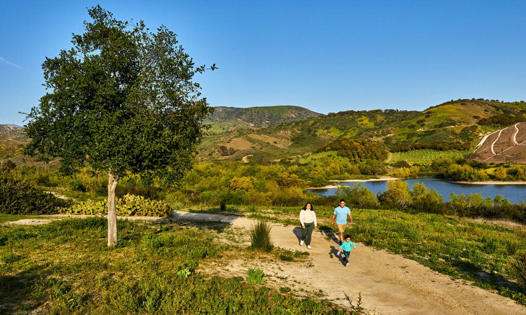
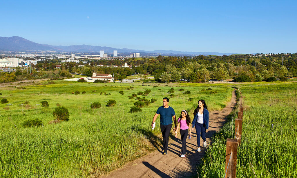
We asked expert Lynette Brasfield to break down the best hiking options. A writer, avid hiker and volunteer trail guide for Irvine Ranch Conservancy, she helps navigate the natural wonderland full of flowers and wildlife all around Irvine in her favorite hikes.
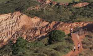
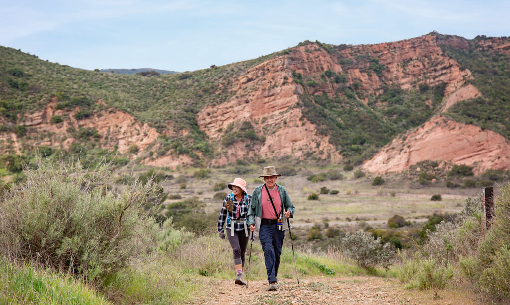
1. Red Rock Wilderness
Wilderness access days only: Sign up at letsgooutside.org
Launch point: Black Star Canyon Road
Good to know: Prehistoric and painterly
Newly opened Red Rock Wilderness offers more than 8 miles of trails alongside stunning red rock vistas reminiscent of our finest national parks. Hike along land that once was home to early crocodiles and rhinos, reveling in your connection with nature and prehistoric life forms.

2. Orchard Hills Loop Trail
Launch point: Orchard Hills Loop Staging Area
Good to know: Tough but terrific
This 3-mile trail meanders around an avocado orchard, with several steep climbs on uneven terrain. Bring poles and plenty of water. Hikers are rewarded with amazing ridgetop views of the coastline and, on clear days, the Palos Verdes Peninsula.
3. Creek Trail
Launch point: Peters Canyon Regional Park entrance off Overhill Drive
Good to know: Footbridges and flowers
Go hiking along the quarter-mile Creek Trail next to trickling water. Benches allow for meditative moments, sightings of songbirds and, in spring, the surprise of half-hidden wildflowers. Screened by vegetation, soak in the serenity as you cross footbridges.
4. Tomato Springs
Launch point: Near Tomato Springs Park at Portola Springs
Good to know: Short and sweet
Tomato Springs is a great option for anyone wanting a short, easy outing in nature with several viewpoint stops. The less-than-half-a-mile hike ends at a hilltop where you can watch the sun set over Irvine and, on clear days, gain a glimpse of Catalina Island.
5. Jeffrey Open Space Trail
Launch point: Cypress Community Park
Good to know: Something for everyone
History buffs will enjoy a series of intaglio panels along the path that trace the past 500 years of the area. The 4-mile-long trail also attracts strollers, bikers, joggers and dog walkers. Grassy areas punctuate the path, which winds among neighborhoods and open space.
6. Limestone to Dripping Springs
Guided hikes only: Sign up at letsgooutside.org
Launch point: Augustine Staging Area
Good to know: A watery wonder
An old ranch road takes hikers past majestic oak trees, sycamores and coastal sage scrub. Narrower trails lead up a small canyon to Dripping Cave, where water falls down ferns and black rock. This beautiful 5.5-mile hike is moderate, with an elevation gain of 440 feet.
7. Bommer Meadow and Nature Loop
Launch point: 1 Bommer Canyon Road
Good to know: Environmental delight
Savor the peace and quiet of Bommer Meadow Trail, then take Nature Loop toward the Cattle Camp to do a 2.75‑mile hike. Experience the sights, sounds and scents of mature coastal sage scrub, native plants and wildflowers. Expect to see rabbits and roadrunners enjoying the natural environment.
8. Hicks Canyon
Launch point: Hicks Canyon Community Park
Good to know: Fabulous for families
Majestic eucalyptus trees provide coveted shade along this 4-mile out-and-back trail, making it an ideal option in the summer months. Easy to follow, it meanders along a dry riverbed and features several playgrounds, restrooms and picnic areas for family fun along the way.
9. Venta Spur Trail
Launch point: Woodbury Community Park
Good to know: Birdsong and beauty
Early morning is the best time to enjoy birdsong along this 3.7-mile trail that winds amid neighborhoods. The paved path meanders past brilliant bougainvillea, tall firs and scarlet firethorn hedges. While stretches include busy streets, there’s plenty to satisfy fans of fabulous flora.
10. Quail Trail to Nix Nature Center
Launch point: Quail Hill Community Center
Good to know: 9 miles to Nix and back
Loop your way from Quail Hill Community Center along this roller-coaster route to Little Sycamore, then descend to the Nix Nature Center. Take a picnic lunch, eat up, fill your water bottle, then return, possibly spotting California poppies. Revel in a sense of accomplishment.
11. Turtle Rock’s French Hill
Launch point: 1 Concordia
Good to know: Steep but stunning
This 4.1-mile loop trail with an elevation gain of 804 feet offers gorgeous views of the surrounding hills. In spring, stop to spot a profusion of wildflowers along the trail, a great excuse to catch your breath on the steeper sections. Flat sidewalks alternate with dirt paths along varied terrain.
12. Laurel and Willow Loop
Launch point: Willow Staging Area on Laguna Canyon Road
Good to know: Delight in discoveries
This nearly 4-mile loop passes the landmark Ghost Rock – also known as Emoji Rock. As you wander along Laurel, step over evidence of an earthquake fault. Hike up to the waterfall – though it’s usually dry – and continue along a shaded trail before returning down Willow.
13. Shady Canyon Trail
Launch point: Quail Hill Trailhead
Good to know: Roadrunners and golf course views
The 7.8-mile Shady Canyon Trail rises gently along a gravel path with views of the golf course and elegant homes. Watch out for deer, roadrunners and quail. Vary your mileage by detouring into Bommer Canyon to breathe in scented sagebrush, or turn back, crossing several bridges.
14. Rabbit Run and Fox Run
Wilderness access days only: Sign up at letsgooutside.org
Launch point: Bommer Canyon Cattle Camp
Good to know: Rare bit of Bommer
Rabbit Run and Fox Run are two fun trails in Bommer Canyon off Serrano Ridge. These trails are rocky and steep, so bring poles, but the descent into the canyon is exhilarating, and the climb up is great for cardiovascular health. You’ll probably see a rabbit, but not a fox.
15. Bommer Canyon
Launch point: Cattle Camp
Good to know: Sagebrush and the city
View Irvine and hillsides after a heart-pumping hike up East Fork, where this time of year you’ll encounter a profusion of purple lupine, then continue down Ridge Route. The 3-mile trail offers plenty of chances to spot songbirds, red-tailed hawks and maybe a gnatcatcher.
16. Turtle Rock And Sunset Park
Launch point: Chaparral Park
Good to know: Ocean and mountain views
The first part of this short 1.7‑mile hike begins with paved stairs, but wear trail shoes with a good grip to tackle the loose dirt and rocks on the incline that leads to the hilltop. Marvel at pink-purple-red sunset skies over the Pacific Ocean as the mountains to the north slowly darken.
17. Quail Hill Loop
Launch point: Quail Hill Trailhead
Good to know: Easy and even
The less-than-2-mile trail is mostly flat, offering a pleasant hike with wide-angle views of Saddleback and Irvine. Look for butterflies and bees enjoying the coastal sagebrush. End with coffee or lunch at the nearby Quail Hill Shopping Center.
18. Crystal Cove Perimeter Hike
Launch point: Pacific Ridge Trailhead
Good to know: Strenuous but scenic
Be prepared for a challenging but lovely 9-mile hike with a 1,500-foot elevation gain around the perimeter of Crystal Cove State Park. Dry sagebrush and chaparral give way to shady oaks in the cooler valleys. On clear days, enjoy hilltop views of the sun‑speckled Pacific Ocean.

19. Mariposa and Sunflower
Launch point: James Dilley Greenbelt Preserve
Good to know: Wondrous wildflowers
The Lake Trail leads to Mariposa Trail, where in spring lovely mariposa lilies bloom and digger bees emerge from their hidden homes in the dirt. The 2.5‑mile trail winds up to a hilltop that offers views of Barbara’s Lake and beyond. Then turn back, descending on Sunflower, which is rocky but rewarding.
20. San Joaquin Marsh Wildlife Sanctuary
Launch point: 5 Riparian View
Good to know: Birders’ delight
A series of ponds ensconced among native plants – including willows, lemonade berry and toyon – attract an abundance of avian life along with binocular–toting birders to this haven for more than 330 bird species. Visit in the early morning or evening, taking it slow around the 2.6-mile loop, marveling at the beauty and the birdsong. The marsh provides easy opportunities to see birds in the ponds, along the trails and flying overhead.